研究・産学官民連携 Research
Looking beneath the earth's surface with Prof. Takeshi Tsuji
- TOP
- Research
- Research at Kyushu University
- Research Close-Up
- Looking beneath the earth's surface with Prof. Takeshi Tsuji
Research Close-Up: Looking beneath the earth's surface
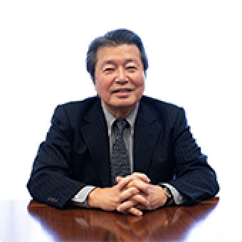
Professor Takeshi Tsuji (below) of the Department of Earth Resources Engineering is developing new methods to explore and monitor the inside of the earth with applications from earthquake mitigation to environmental management. In this close-up, the first of a new series highlighting the wide range of innovative research at Kyushu University, science communicator William J. Potscavage, Jr., explores what makes Tsuji's research unique based on a conversion the two had.
Break a bone, and the doctor will probably take an x-ray. Injure a muscle, and an MRI may be in order. But what if the patient is much, much bigger? What if the patient is the earth?
Imaging the structures and changes occurring inside the earth over tens of kilometers requires new measurement and analysis techniques unlike those used for our bodies. Nonetheless, such information is vital for improving our understanding of earthquakes and developing strategies for disaster response.
Professor Takeshi Tsuji of Kyushu University’s Department of Earth Resources Engineering is tackling this problem by combining math and seismology to get a better picture of exactly what is occurring inside the earth.
Using powerful computers to analyze data from land, sea, and sky with new models, Tsuji and his group are pushing the bounds of seismology research. But his contributions go far past just the theory as he is also active out in the field, whether driving around the island of Kyushu or boarding drilling ships and submersibles out in the ocean.
From imaging to monitoring
Not a pure seismologist by training, Tsuji is applying methods from his background in natural resource exploration to the study of the earth and earthquakes.
“In addition to seismology conferences, I also participate in those on subjects from resource exploration to water dynamics and petroleum engineering, and pulling together ideas from these different but related areas helps give me new insight,” says Tsuji.
For example, pore pressure—the pressure of fluids in the pores of rocks deep below the earth’s surface—is an important parameter for evaluating oilfields, but it is also important for faults. Faults with high pore pressure can move more easily, making them prone to earthquakes.
Looking at previously reported data from the Nankai Trough—an area under the ocean associated with major earthquakes in Japan—with improved models, Tsuji was able to predict pore pressure in the area and form a clearer image of the faults in a particularly important region.
Changes in seismic velocity across Japan on September 9, 2016, calculated by Tsuji's lab from ambient noise
Another topic that Tsuji has spent considerable time researching is the monitoring of seismic velocity—the speed with which vibrations travel through the ground. Changes in velocity indicate activity underground.
Studies have traditionally relied on a controlled source of vibrations, such as an air gun in the ocean, picked up by sensors on land or the ocean floor to get data for such analysis.
However, Tsuji’s group is finding that naturally occurring vibrations from sources such as minor earthquakes, large buildings shaking in the wind, and heavy trucks travelling on roadways can also be used.
By analyzing when minor vibrations, which are generally detected as noise at seismology stations, originating from the same source arrive at different pairs of seismometers, Tsuji’s group has mapped changes in seismic velocities over time.
So far, they have used this technique to map changes in the earth before, during, and after an earthquake and understand stress in faults under the ocean.
Such techniques aid both the understanding of earthquakes and are promising for future real-time tracking of changes in the earth with applications in earthquake prediction.
Into the field
While the large network of seismometers already established in Japan provides a vast set of publicly available data for his research, Tsuji also actively goes into the field.

Some of the several seafloor locations Tsuji observed before and after the 2011 Tohoku earthquake [1]
He has spent considerable time on drilling boats and submersibles doing measurements of the ocean floor, and this eagerness to collect data has been essential to enabling some of his research.
Several years before the 2011 Tohoku earthquake, which triggered a tsunami with devastating effects on the northern parts of Japan, Tsuji travelled on the submersible Shinkai 6500 as part of an expedition to deploy seafloor observatories and explore the fault that would later be attributed to the tsunami.
He again visited the site after the disaster, and comparison of images and data from the same areas before and after the earthquake provided invaluable data for understanding how the tsunami occurred.
Back on land, communication with locals about changes in the flow of hot springs after the 2016 Kumamoto earthquake in southern Japan led Tsuji to find that a block of land nearly 2-km wide and 50-m deep had slid as a result of the earthquake.
Locals were relieved to know the source of the hot springs, which are a key part of the area’s economy, were unaffected, and Tsuji was able to document this unique land movement.
“I think that one of the keys to my research is being able to collect, work with, and combine a broad range of different kinds of data to gain a more complete picture of what is happening,” says Tsuji.

Tsuji visits Kumamoto to directly observe land changes after a major earthquake
And his approach to seismology research has been gaining attention, as he was selected for a prestigious Early Career Scientist Award from the International Union of Geodesy and Geophysics (IUGG) in 2018.
This is the first time back-to-back awards, which are given every four years to less than 10 scientists in a variety of categories, were given to professors at the same university, with Professor Futoshi Takahashi receiving one in 2014.
Improvements in seismology sensors have Tsuji excited for what is coming next.
“Although seismology sensors had seen only slow progress in the past, innovation has recently accelerated,” says Tsuji.
Not only are sensors getting smaller and easier to deploy, as Tsuji is already doing himself around Kyushu, but he expects to see optical fibers that can measure vibrations at various points over tens of kilometers soon, opening new possibilities.
Untapped storage space
Tsuji is also a division head of Kyushu University’s International Institute for Carbon Neutral Energy Research (I²CNER), where his work focuses on carbon sequestration.
Using models and techniques similar to those for his seismology work, Tsuji and his group are looking for places in the earth to store carbon dioxide released during energy production.
“The earth has an abundance of space to store gas, and we need a solution to the current excess of carbon dioxide until we can reduce dependence on fossil fuels,” says Tsuji.

Tsuji discusses with a group member
Thus, his group is modeling the pores in rocks inside the earth to understand where carbon dioxide can be stored, how much is stored, and how to get it back out if needed, which are all necessary to make long-term storage and control possible.
Carbon sequestration could also prove crucial for responding to unpredictable sources of carbon, such as a major volcano eruption or a huge release of methane from the ocean or permafrost, which would have disastrous repercussions for humankind if unmanaged.
These days, Tsuji spends less time in the field and doing his own analysis as his responsibilities have increased, so he relies more on his research group, which includes one assistant professor and nearly twenty students.
Nonetheless, he shows no signs of slowing down. In his research notebook, he has over 100 ideas that he has yet to start pursuing. And he has not limited himself to the earth either, as he notes that he is now applying similar techniques to search for resources such as ice on the moon.
With his team in place and the ideas still coming, Tsuji looks to continue advancing our understanding of what is happening inside the earth and how to control our impact on its climate.
Kyushu University’s science communicator, William J. Potscavage, Jr., and Tsuji sit down together for a discussion that would become the basis for this close-up.
- TOP
- Research
- Research at Kyushu University
- Research Close-Up
- Looking beneath the earth's surface with Prof. Takeshi Tsuji


